| |
 |
 |
 |
Rhumb Lines and Map Wars
A Social History of the Mercator Projection
 By Mark Monmonier
Chicago: University of Chicago Press, 2004
256 pages. $25
isbn: 0226534316
I was a fan of The West Wing in its first few
seasons, and I recall an episode in which the press secretary, C. J.
Cregg, is cornered and subsequently closeted with a band of radical
cartographers who lobby for every public school to adopt the Peters
projection of the world map. This method of turning the round globe into
a flat surface was promoted by the late Arno Peters (1916–2002), a
German historian, and is allegedly fair to all peoples. In the map wars of
the 1970s and 1980s, the traditional Mercator projection, named after its
inventor Gerard Mercator (1512–1594), was accused of a kind of
cultural hegemony, or even racism, for diminishing the relative size of
developing nations compared to the First World. Mercator maps cause
landmasses near the poles (Europe and North America) to balloon in size
compared to those near the equator (Africa and Latin America).
The Peters projection, by contrast, is supposedly area accurate,
ensuring that the relative sizes of countries are correctly depicted.
At the end of the show, C. J. emerges from the meeting
with the stunned abstraction of one who has experienced a
continental shift, so to speak, in her basic worldview. After the
episode aired, sales of the world map based on the Peters projection
reportedly skyrocketed overnight.
In Rhumb Lines and Map
Wars: A Social History of the Mercator Projection, Mark Monmonier, a
professor of geography at Syracuse University, offers an in-depth, balanced,
and at times quite technical study of Mercator’s projection specifically, and the
history and methods of map projection in general. The complexity of
some portions of the book is hinted at in the title—a rhumb line is a
nautical term, defined by the Oxford Universal Dictionary as
“any one of the set of lines drawn through a point on a map or chart
and indicating the course of an object moving always in the same direction.”
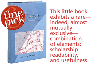
This little book exhibits a rare—indeed, almost
mutually exclusive—combination of elements: scholarship, readability,
and usefulness. Monmonier’s purpose is to address the
Mercator map and its critics with what he calls “informed
skepticism,” a goal he achieves by clearly
representing all sides of the argument. Although not a textbook
on map projection, the book is a handy introduction to the subject and
contains as much information as the nonspecialist is likely to need.
As any cartographer will tell you, no flat map of the
world can accurately represent all distances. Mercator’s projection
was devised primarily for navigators, and we’re all familiar with his
equatorial-projection maps that show Greenland bigger than China, India
smaller than Scandinavia, and an amazingly massive Antarctica.
Monmonier’s book is the story of how map projections devised for use
during the age of sail were also used well into the twentieth century as
land maps. Since the age of sail (1450–1850) ran parallel to the age
of European conquest and hegemony, these projections came under fire during
the culture wars of the last few decades.
The first chapter offers an overview of the
mathematics of map projection and its history. Chapter two covers early
sailing charts (the portolan tradition), and chapter three discusses
Mercator’s life and works. Chapter four is useful to the
scholar and the collector, as it details how Mercator’s maps were
reproduced over time, what was lost or altered in those reproductions, and
to what extent they are accessible or available today. The fifth chapter
discusses how later discoveries and contributions by mathematicians such
as Edward Wright (1561–1615), Henry Bond (ca. 1600–1678),
Thomas Harriot (1560–1621), and Richard Norwood (1590– 1675)
promoted a wider use of Mercator’s projection in navigation. Chapter
six reveals, however, that because Mercator sailing requires reliable
methods for taking bearings and determining position (including an accurate
marine chronometer), it wasn’t until the eighteenth century that his
projection became “the gold standard of marine cartography.” Chapter
seven examines how military uses of maps influenced the development of map
projections (initially used around the turn of the twentieth century to aim
long-range, rapid-fire field guns), and chapter eight discusses similar developments
in response to the beginning of long-distance flight.
The final three chapters focus on the social history
part of the book’s subtitle. In the 1990s, according to Monmonier,
the Peters map became the “emblem of diversity awareness,
marketed as the cornerstone of a catholic cartography in which
dissimilar images of the world promote cultural sensitivity.”
It was hoisted as a standard by postcolonial deconstructionists
“poised to slay dead dragons.” In the end, Monmonier
convincingly concludes, “Peters’s proponents ignored decades of
pointed criticism of the Mercator map by academic cartographers and
its wholesale abandonment by map publishers in the 1940s. Their
simplistic scenario linked the Mercator map to an unsympathetic
cartographic establishment and aligned the Peters map with
pro–Third World organizations…To help their readers understand
the controversy, newspapers and magazines juxtaposed examples of the
Mercator and Peters world maps—as if these were the only
choices—and used visual propaganda to put professional cartographers
on the defensive.”
Mercator-projection maps still decorate classroom
walls, mostly because the supply catalogs upon which teachers rely still
promote them. Like Monmonier, I am not convinced that the
worldviews of thinking people are significantly influenced by a wall map,
whatever its method of projection. After reading this book carefully, and
weighing the arguments, the reader will realize that perhaps the best solution
is simply to go out and buy a globe.
Richard Ring is Reference
and Acquisitions Librarian at the John Carter Brown Library at Brown
University.
|
 |
|
|