Blueprints
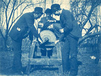
Depending on the paper handling capabilities of the machinery and its electrical load, a mechanized blueprinter like the St. Petersburg machine sold for $650-$1200. The washing and drying apparatus that was attached to the back added about another $500-$700 to the cost.
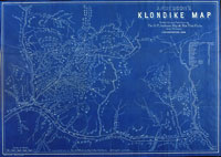
Although the first production of blueprint maps for commercial purposes almost immediately followed the Philadelphia exhibition, the practice did not meet widespread acceptance until the Klondike gold rush of the late 1890s. Would-be gold seekers were desperate for information on the gold fields of Alaska and the Yukon and willingly accepted (and paid for) maps that had been quickly produced by blueprinting. After the gold rush, several of these companies maintained commercial production well into the 1930s.
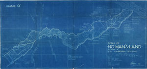
Campaigning on the other side of the world from the Klondike gold fields, the intelligence branch of the Anglo-Egyptian army found blueprinting a useful way to duplicate field maps and sketches. Their lead would eventually be followed about seventeen years later by both sides in the First World War where blueprint maps were produced for frontline troops in the tens of thousands.
Although it is nearly impossible to assess the number of printing machines that were in operation, some indication of the popularity of blueprinting is hinted at through paper use. By the time the St. Petersburg machine went into production in 1927 at least thirty companies in the United States were producing pre-sensitized paper for the industry. Their combined annual output was nearly twenty-four million feet of rolled paper. Thirty years later, a single government department in Minnesota, using a more modern Pease printer, consumed as much as two million square feet of rolled paper a year. The six-man printing crew did not design, survey, or build highways, but their blueprints were in high demand by every engineer, surveyor, and contractor working for the Minnesota Department of Highways. “If we were printing money,” commented the blueprinter section chief in a 1958 Minnesota Highways article, “we could finance the Interstate highway network in a month.”
Despite its popularity, blueprinting has received little attention from map historians. Its existence is taken for granted, and its creation regarded as unimportant. The monochrome dark blue tones that characterize blueprint maps often do not measure up to the wonderful line work and colorful artistry of early lithographed and engraved maps, and consequently, are less desirable as collectibles. Yet, as an aspect of printing technology, surely blueprint maps deserve at least some representation in our public collections.
Without a proper history of the blueprint industry many people have incorrectly associated the technology with the last few decades rather than with the output of surveyors and cartographers of the late nineteenth and early twentieth centuries. Some archival institutions have been known to routinely pull blueprint maps from their collections on the assumption that they are not original records. But blueprints can be as old as some of the more heavily studied mapping technologies of lithography and copperplate engraving, both of which were popular when blzxueprinting was first introduced.
If a more definitive history of blueprint maps were to be written, we will probably find that the technology played a transformative role in the growth of the map trade and in the increased use of maps by an informed public.


