


Tracking America
Railroad Maps and Brochures Told an Intrepid Nation Where to Go
By Derek Hayes
Presidents no longer travel by train to take the oath of office. But inaugurals were once an occasion for grand railroad trips, punctuated by speeches along the way. In 1861, Abraham Lincoln made a twelve-day, 1,900-mile speech-filled train journey before his inauguration back to his home state of Illinois that was famously so very much shorter than the three-weeks it took, by stagecoach and steamboat as well as railroad, when he first traveled to Washington in 1849. By 1861, in fact, Lincoln could have made the journey in two days had he cut out the speeches.

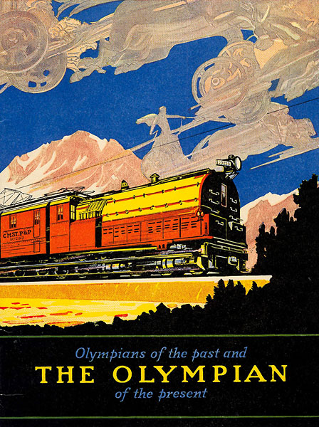
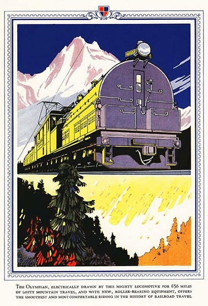
 pitching the Olympian.")


Given the central place of train travel in our nation’s history, it’s not surprising that railroad ephemera remain in high demand. Rail fans snap up all manner of railroad-related bits and pieces. Paper—in the form of maps, timetables, brochures, and the like—is just one part of this vast collecting empire. The popularity of railroadiana is not only due to the fascination of the massive machines that run on rails, but also to the historical fact that the railroads created modern America, and opened up the West like nothing else ever did.
Unfortunately for the impecunious, the large number of collectors competing for railroad items tends to drive up prices. Fortunately, however, many railroad maps and timetables, because they were needed by everyone on a day-to-day basis, tended to be printed in large numbers, so the survival rate is usually quite high. It is only when one gets to the older and rarer items that prices go wild.
The railroad began its American web in the 1830s. Some of the earliest tracks were portage railroads connecting navigable waterways, then the preferred method of travel. The famous DeWitt Clinton locomotive, named after the governor of New York, began service on the Mohawk and Hudson Railroad, between Albany and Schenectady, in July 1831, bypassing extensive—and slow to traverse—locks on the Erie Canal. By 1840 there were 2,808 miles of track in the United States, principally built to extend the trading areas of seaboard cities, but they did not connect to each other and formed no coherent network. The earliest railroad map I have come across is an 1828 survey for a railroad, one connecting Boston with Providence, Rhode Island. This is a relatively unique item, however, one not likely ever to appear for sale.
Survey maps that do appear for sale quite regularly, and at quite low prices, are maps from the great Pacific Railroad Surveys, done in 1853-1856 to try to determine the most feasible route for a railroad to the West Coast. These have been extracted from the voluminous survey books themselves, which seem to have been printed in quite large numbers. As we all know, the surveys themselves failed to produce results due to the political bickering of this period leading up to the Civil War. Too many apparent advantages were to be gained by either the South or the North to allow either to proceed. The government minister of war responsible for overseeing the surveys was none other than Jefferson Davis, soon to be the one and only president of the Confederate States of America.
By 1859 railroad tracks had reached the Missouri by the combined efforts of private railroad enterprises linked together; the Hannibal and St. Joseph Railway connected its namesake cities on the Mississippi and the Missouri (whence originated the Pony Express, so named because it connected with the railroad).
We find railroad maps increasing in numbers with the completion of the first transcontinental in 1869, the combined Union Pacific and Central Pacific line to Sacramento, California. The South’s opposition in Congress having gone the way of the Civil War, the 1860s ushered in the era of large land grants as a way to allow railroads to finance their way west. Other transcontinental railroads received such grants at this time, though for various, usually financial reasons, were unable to act on them until later decades. The grants were not actually dispensed until the railroad had completed the section of track through which it passed. But in order to finance construction railroads started to produce considerable volumes of advertising material, including maps, to sell the land that they would soon be acquiring, and there are many maps showing the grant land—alternate sections excepting reserved sections and preempted land—for sale. Such maps come up on online auctions sites from time to time and often sell for only a hundred dollars or so, largely, I imagine, because they were also produced in relatively large numbers originally and copies still show up in estate sales.