In the Trenches
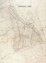
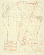
An estimated 30 percent of the information on German targets that was plotted on the 1:20,000 maps was collected from the aerial photos supplied by pilots and balloonists. The information could be compiled, mapped, and in the hands of frontline troops in as little as six hours. Balloon observation, as a form of aerial observation, was heavily used mainly at the beginning of the war. The development of German long-range medium artillery eventually forced the balloons to be placed too far to the rear for obtaining good information, even if the lighting conditions were favorable. Although anti-aircraft fire kept observation planes at a great height, aerial photos revealed much of what pilots could not see while fighting the numbing cold and enemy aircraft. “It was impossible to have guns deployed at the same point and in action for weeks or months,” Lieut.-Col. H.H. Heming reminded everyone after the war, “without the position being given away in the air photograph by tracks and gun pits, no matter how one tried to camouflage it.” Although it took time before there was a system capable of taking vertical snapshots from an aircraft’s underbelly, aerial photography got better and better and was amazingly good by 1917. It eventually reduced the error factor in mapping German targets to less than 20 yards, well within the range of acceptability required by British gunners.
With the help of the new maps and accurate target identification, the BEF was able to fine tune its map shooting and turn its big limbering guns into sensitive weapons. The battle for Messines ridge in the summer of 1917 was a good case in point. After the British-led assault, Maj.-Gen. Franks of the Royal Artillery personally examined the battlefield to check on his gunners’ handiwork. “We went over all those German battery positions and compared them with our records,” he recounted after the war. “We found on comparing results…that we had got over 90 percent of the German guns absolutely accurately located.” The German batteries had been carefully identified in the weeks leading up to the battle. The hidden BEF guns sited on the targets and systematically eliminated each one in the early hours of the assault, before the infantry had even left their trenches.
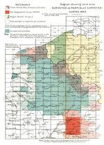
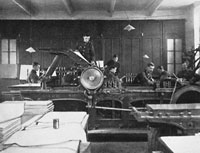
When the BEF sailed for France in August 1914, its mapping needs were under the supervision of a single officer, Major E. M. Jack, RE, and a clerk. By the end of the war in 1918, the BEF’s survey organization had grown to some 5,000 officers and men, and had turned out more than 35 million map sheets. The new maps on average were printed in four colors, each of which required a separate impression. This meant the British printing presses, in a three-year period, had handled a phenomenal 140 million passes.
In its day, the Great War was the largest survey and mapping operation undertaken in history. No previous military engagement had so thoroughly exploited their potential. Today, trench maps provide an important visual record of the conflict that cannot be duplicated from other sources and stand as a noble testament to the hardships experienced by frontline troops as they faced the horrors of the battlefield.
Trench Maps Today
All maps issued by the BEF were to be treated as ‘secret’ publications. They were not to be sent out of the country without the permission of General Headquarters, and were not to be issued to formations below the level of Brigade Headquarters. In theory, their circulation was to be strictly controlled by giving each item a serial number and by keeping a record of its distribution. Departures from this practice, however, were frequent, which is not surprising given the volume of material produced and circulated on a daily basis. Illegible and torn maps were replaced without reprimand, but any item that was lost or misplaced was not taken lightly.
Whenever a new edition of a map was released to units in the BEF, the superseded edition was supposed to have been returned to the map distribution office so it could be destroyed. This process ensured that older, out-of-date maps were not mistaken for the new. More important, it meant that maps would not be discarded near the Front, where they might fall into German hands. Unfortunately, little effort was made to preserve examples of each map produced—the war prevented such luxuries. As a result, many editions are almost impossible to find today, even though at one time there were thousands in circulation.
Individual fighting units often attached copies of maps to their operational records and war diaries. Many of these are now available at the Public Records Office, Kew, England. Other large holdings of trench maps are also at the British Museum and the Imperial War Museum, both in London. Unfortunately, few of these items are available online. Closer to home, the William Ready Division of Archives and Research Collections at McMaster University, Ontario, Canada, recently added some 400 trench maps to its web site.


