Comic Cartography
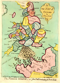
In the hands of a skilled cartoonist, entire continents can take on humanlike qualities that are often representative of national stereotypes, some of which are not very flattering. Great Britain in the shape of King George III, squatting and spewing a fleet of ships from his royal backside into the face of France is not a very complementary portrayal of British decorum. However, it is a shrewd comment on English patriotism to a supposed French threat to Britain’s sovereignty.
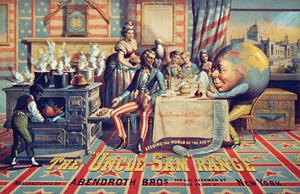
The maps and globes created by cartoonists are deliberately kept simple; they include only the barest of detail, just enough to make the point or to make certain associations without all the ambiguities inherited in written words. Canada, portrayed as a baker and offering a bowl of porridge to a hungry Great Britain, would make neophyte cartographers shudder at their drafting tables, but the simplicity of the image allows the message to be easily absorbed without much reflection. This simplicity is probably one of the most powerful weapons at the disposal of the cartoonist. The old mapmaker’s cliché that “a picture is worth a thousand words and a map is worth ten thousand” is never more true than when it comes to the cartoonist’s pen.
Another famous example is Saul Steinberg’s “View of the World from Ninth Avenue,” which ran on the cover of the New Yorker magazine in 1976. It is a humorous (perhaps stereotypical) depiction of how New Yorkers see the world, in which the entire United States is the same size as three New York City blocks. The image has inspired similar works of comic cartography.
Serious academia and collectors alike have, on the whole, overlooked satirical cartography. It is probably one of the few map genres that is still within the price range of the average investor, and a first-class collection can still be put together for a relatively small investment. Original artwork for modern-day political cartoons can often be purchased directly from the cartoonist for $200-$500 depending on the popularity of the cartoonists, and the demand for their original works. Historical caricatures are, of course, priced higher but are still within the reach of most moderate purchasers when compared to other cartography of the same era. Sometimes the historical imagery may not be completely understood by modern-day viewers and researching the origins of the drawing and its message can occupy many pleasant hours.
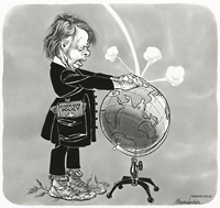
Although political cartoons have been with us for centuries, their targets have changed little over the years. Cartoonists mainly lampoon public figures, especially those who remind us of the differences between the have and have-nots—our politicians, the rich, and the famous—and the various aspects of our lives that they control. Concerns for the environment, national identity, the balance of power, and regional disparities are among the most frequent themes that cartoonist use their cartographic skills to lampoon. They may be designed to appeal to the eye, but cartoons really address the mind. When a map or globe is added, the caricature will challenge our traditional perceptions of the world, and in doing so, will perhaps offer future viewers with a ‘street-wise’ history of our times. Whatever their purpose—education, persuasion, reflection—satirical maps deserve to be taken more seriously by cartographic aficionados.
Further reading
Desbarats, Peter and Terry Mosher (1979). The Hecklers: A History of Canadian Political Cartooning and a Cartoonists' History of Canada. Toronto, McClelland and Stewart.
Hill, Gillian (1978). Cartographic Curiosities. London, The British Library.
Vujakovic, Peter (1990). “Comic Cartography,” Geographical 62(6): 22-26.


